
KEY CHALLENGES
⚠️ Are legacy systems limiting your ability to simulate GPS and jamming scenarios for SIGINT operations?
⚠️ Are your ISR mission planning tools outdated for modern, multi-domain environments?
⚠️ Struggling with line-of-sight communication breakdowns due to flight path constraints or antenna blockages?
⚠️ Is your flight test planning still dependent on manual processes and experienced engineers’ intuition?
“Today’s operational environments demand more than static maps and outdated track data.”
Ansys STK: Precision Mission Modeling for Every Domain
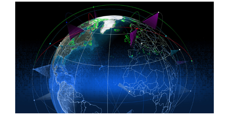
Ansys STK (Systems Tool Kit) offers high-fidelity simulation across land, sea, air, space, and cyberspace. Model satellites, aircraft, sensors, RF links, and dynamics in a 3D, physics-based environment to make decisions faster, smarter, and with higher confidence.
Key Capabilities:
-
GPS Signal Simulation & Anti-Jamming Analysis
-
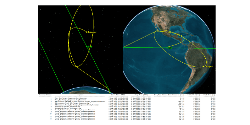
ISR and Reconnaissance Mission Planning
-
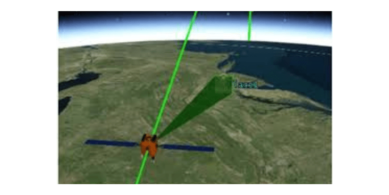
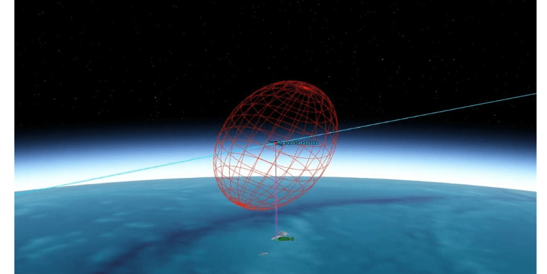
Sensor & Radar Modeling
-
Communication Link Analysis
-
Satellite Constellation Design
-
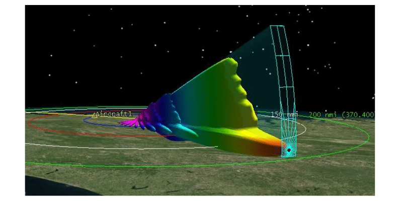
Aircraft Coverage & Terrain Blockage Simulation
-
Real-Time Visualization in 2D/3D
Transform Your Digital Engineering with Mission Modeling – In 4 Steps
-
Build a Scenario
Define your mission environment in STK’s dynamic sandbox. -
Add Models
Simulate system behavior using low to high-fidelity models. -
Analyze in Context
Assess geometry, physics, and interactions in real-world conditions. -
Visualize & Decide
Create reports and 2D/3D visuals to drive confident decisions.
PRODUCT FEATURES
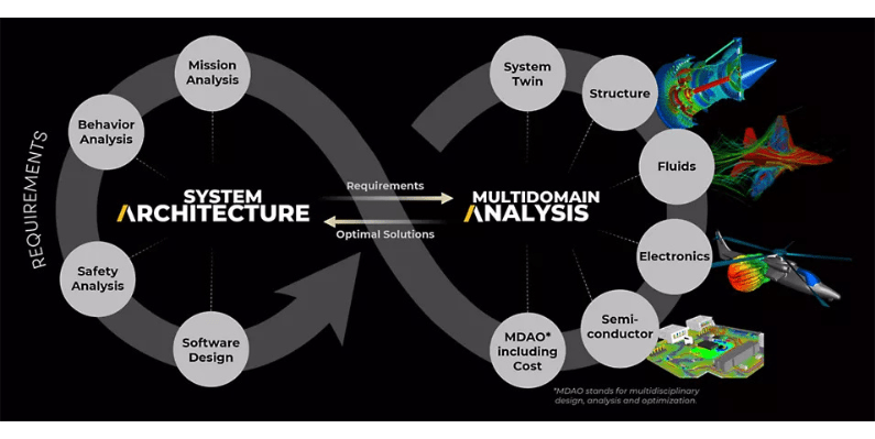
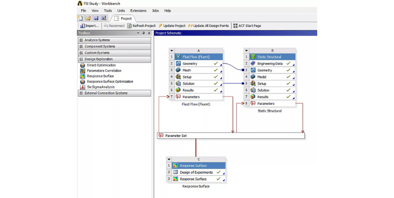
Model-Based Engineering with STK
It represents complex system-of-systems architectures by integrating multi-fidelity digital engineering models across the entire lifecycle.
Communications Modeling With STK
Detailed modeling of communication systems, including all physical elements and the surrounding RF environment.
Radar System Modeling With STK
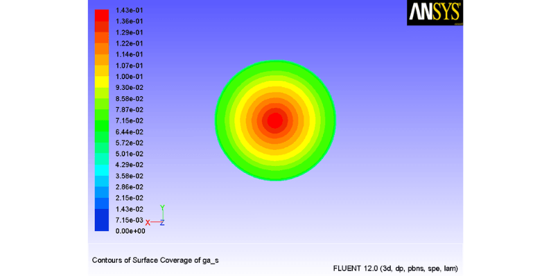
Simulate radar performance in SAR and search/track modes while designing and analyzing monostatic, bistatic, and multifunction radar systems.
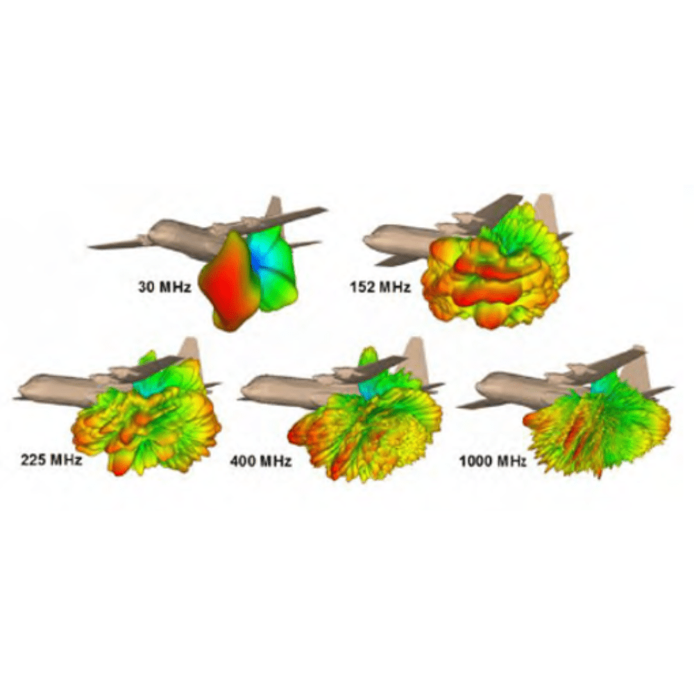
EOIR Sensor Modeling With STK
Simulate electro-optical and infrared (EOIR) sensors for detection, tracking, & imaging performance across the full system lifecycle.
Astrogator: Advanced Space Trajectory
Design and analyze spacecraft trajectories. Astrogator supports the full mission lifecycle.
Conjunction Analysis
Identify and evaluate potential space collision risks. This suite includes four powerful tools designed to assess close approaches.
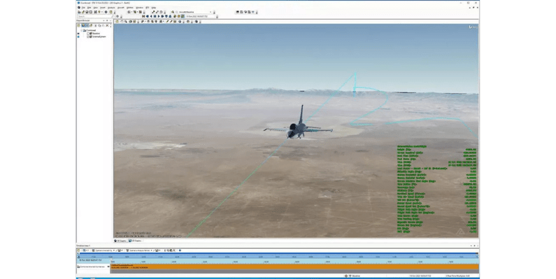
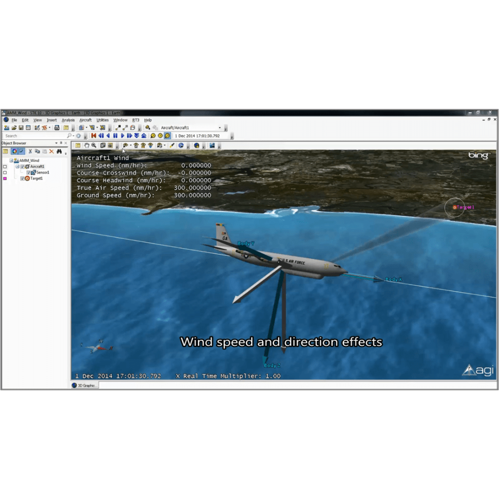
Aviator
Accurately simulate aircraft behavior by incorporating real-world variables like airframe characteristics, weather conditions, and atmospheric effects.
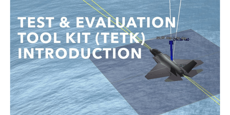
Test and Evaluation
Enhance the entire test and evaluation process within the digital engineering workflow. Use TETK to develop detailed test plans.
Coverage Analysis
Advanced visibility assessments across distributed regions using multiple sensors or platforms. Generate detailed reports.
Analysis Workbench
A robust set of tools for defining custom calculations based on time, position, and reference frames. With both built-in components and the ability.
Quick Specs
Space Mission Systems Design
Space Operations
Air Mission Systems Design
Advanced RF Systems Design
Multidomain Concept of Operations
Telecommunications Network
Electro-optical Infrared Sensor Systems
Defensive System Evaluation
Coverage Analysis
[COUNTER_NUMBER id=8967]
Additional Functionality
STK Aviator
- Modes of flight: Powered, electric, and non-powered flight modes
- Flight envelope tool: Use non-standard
Antenna Characterization
- MANY different antenna types
- Analytical
- Dipole, Helix, Parabolic, Square Horn,
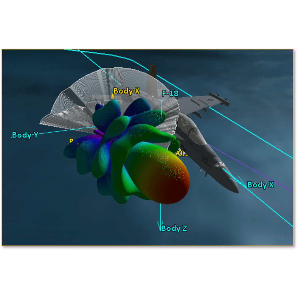
+ Body Masking & Attenuation
- Perform trade study with body masking
- Estimate ideal link budget with body masking
EO/IR Emulation Systems
Ansys Modeling simulates
Ansys Modeling simulates real-world physics for accurate engineering.
Air Vehicle Operator & developer
Air Vehicle Operator & Developer builds and operates aerial systems.
Mission-Driven Autonomy
Develops autonomy software focused on mission objectives.
Auto Synthetic Data
Generates synthetic data automatically for AI training.
Optimizing Antenna Placement
Improves performance by optimizing antenna locations.
Expanding Cosite Scope
Expanding Cosite Scope To Support Mission Design And Model-Based Systems
ABOUT US

Ansys Certified Elite Partner
Ansys is the global leader in engineering simulation. Ansys engineering simulation and 3D design software delivers product modeling solutions with unmatched scalability and a comprehensive multiphysics foundation.
OVERVIEW
3D engineering was incepted in 1999 with the aim of becoming the market leader in providing PLM Solutions to the manufacturing industry. Till date, we have served more than 1400 enterprises across diverse geographies and has become the leading channel partner for Siemens Industry Software, Distributor for ANSYS, Distributor for EOS Additive Manufacturing solutions and CAE & Manufacturing Simulation Services provider in India. With our headquarter in Pune, 3D Engineering has a presence through field engineers in West India (Pune, Mumbai, Gujarat, Aurangabad) and South India (Bangalore, Chennai, Hyderabad). We have numerous certified trainers on our board with many years of valuable industry experience. We offer effective customer support services and are committed to deliver more value to our customers businesses by providing better returns on their investments.